


ON THE SQUARE
60 Years of Memories of Butler
by James Ring
Butler Floods
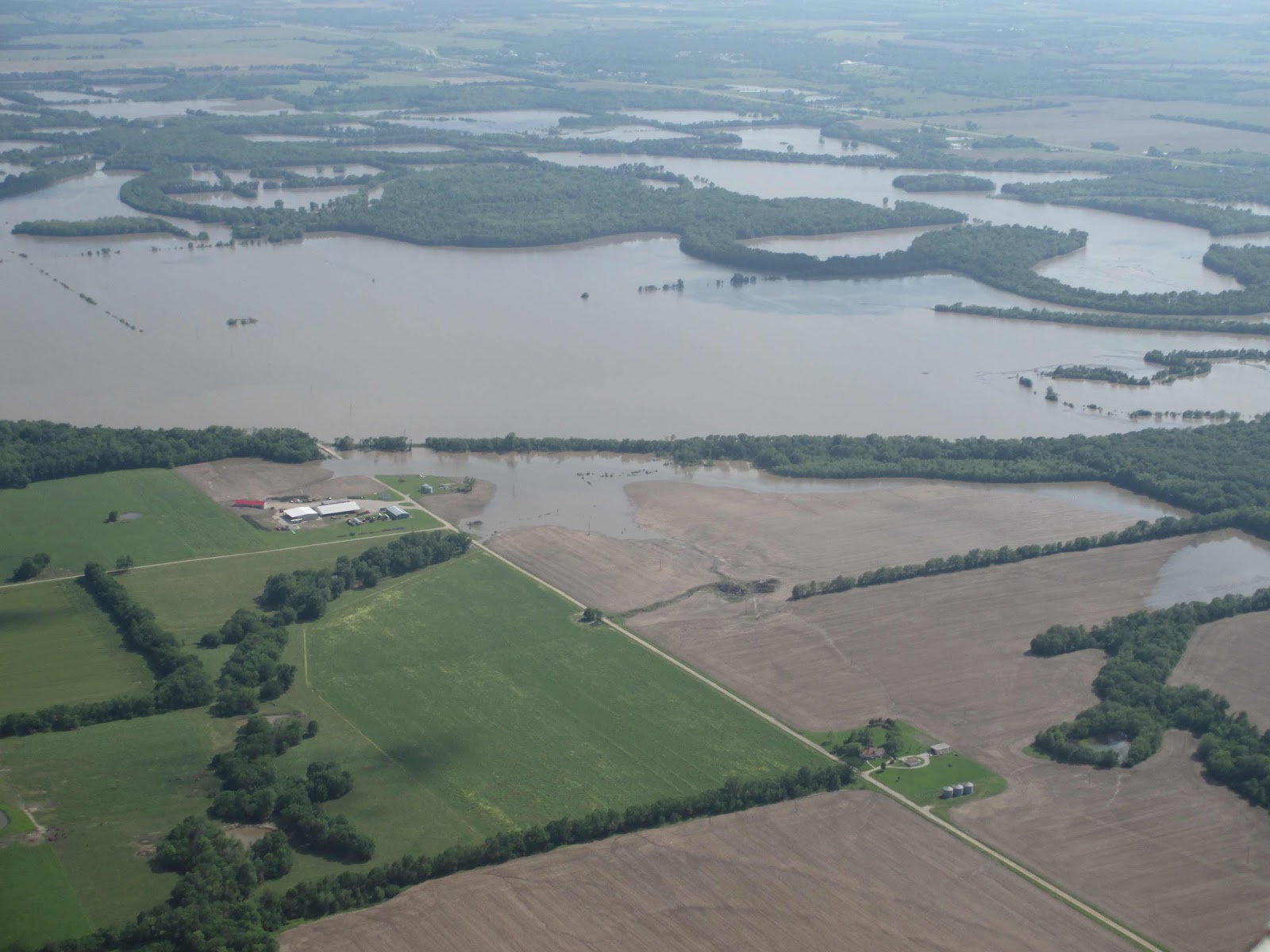
Being located in the flat prairie of Lapland, where Kansas laps over into Missouri, Bates County has always been prone to flooding. Not in the sense of rolling whitewater, but by big expanses of backwater that pushed out over fields, roads, houses and other human influences. It wasn’t for nothing that the early French explorers called our local river Marais de Cygnes for “marsh of the swans.”
Most of the town of Butler may have been located on relatively high ground, about 100 feet above the river bottom land, but there are plenty of low spots around it that can flood during rainy conditions. I recall one particularly disastrous morning when I was inbound to Butler from the eastern part of the county. Deepwater Creek was out of its banks over H highway, and diverting north to D highway didn’t work because of water over the road at Stony Point east of Passaic. I finally backtracked up Z highway and zig-zagged to Passaic to come into town from the north.
In the 1960s, before four-lane U.S. 71 was built, it was common for the flats south of Butler to have standing flood waters covering the old two-lane 71 slab. I remember seeing a Missouri highway department truck leading a convoy of cars through the six-inches or so of water over the road. Part of Rattlesnake Hill, of course, was sacrificed to build the huge fill across the bottoms that we drive on today.
One learned which spots to avoid during heavy runoffs. South Main street at Mound Branch often flooded; Fran Haney had to be rescued from her house by boat one time. West 52 highway can flood temporarily at the railroad underpass, and west of town the Miami Creek bottoms could put water over 52 highway, west of the bridge. The same water closed county roads west of Three-Mile corner, south of Butler.
On one occasion, Butler became an island for part of a day. The main roads north, south, east and west were blocked by flood waters. I don’t remember if the railroad was washed out on that day, but there have been times that the Missouri Pacific’s roadbed was damaged enough to stop rail traffic.
The real old-timers always talk about the floods of ’51, when Kansas City was devastated by the overflowing rivers in 1951. We young whippersnappers are more prone to recalling 1993, when the Missouri River turned into a miles-wide lake. But Butler and Bates County has had its share of Big Water, just on a smaller scale. The Rich Hill and Papinville residents know all too well that B highway can become impassable, and further south, in Vernon County, the Little Osage and Marmaton rivers will wreak havoc.
Even the vaunted “Interstate 49” can be topped by flood waters. I have witnessed the Marmaton floodwaters cascading over the banked curve west of Compton Junction, and I’ve seen farm machinery parked on levees down in the bottoms, with only the tops of the cabs sticking out of the water. Nature rules, mankind’s puny influence notwithstanding.

