


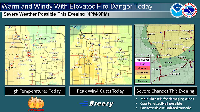
Warm temperatures are expected again today with highs in the upper 60s and lower 70s. However, it will be breezy with gusts out of the south to 35 to 40 mph this afternoon. This will lead to another day of elevated fire danger and burning is highly discouraged.
This evening a few strong to isolated severe storms will be possible ahead of a cold front across northern Missouri between 4PM-6PM.
The main chance for severe weather for the bulk of the area will come between 6PM-9PM when the cold front moves through. The main threat will be for damaging winds however, quarter-sized hail and perhaps an isolated tornado cannot be ruled out.

